Visitors 27
Modified 13-Sep-11
Created 12-Sep-11
174 photos
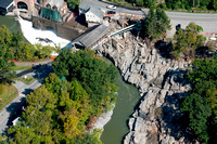
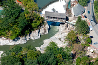
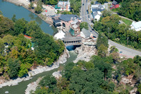
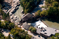
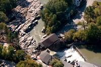
Aerials around Quechee Vermont showing the destruction and progress of rebuilding the golf course, roads and bridges, two weeks after the storm. The flight extended from Quechee along Rout 4 and the Ottauquechee River West bound through Taftville, Woodstock, Bridgewater Killington and the hartland Dam.
© Aerial Design Aerial Photography